Ode to My Compass

That day that I lost you, I truly lamented

For though you were old, beat up and dented

I’d carried you with me over reentrants and trails,

And you pointed the way, always true, without fail.


North became South without you by my side,

“Where am I?“ I walked in circles and sighed.

No longer to feel your comforting weight

Upon my left thumb marked a ghostly constraint.


Your bright neon strap and big fat red needle

Gave me my bearing, and the courage to ramble.

As a beginner I knew I had a long way to go,

But counting my paces with you, I would grow.


A gift from my father, the M70 master,

You’d been my sidekick through every disaster.

Two years we’d done battle, from Yellows to Greens,

With you in my hand I’d even braved A-meets.


At NAOC, dear compass, who knows what happened?

At West Point, I was broken, and Up North, just flattened.

At the Stumble I faltered, for the hills were so great,

But you kept your arrow aimed perfectly straight.


Outside of Delco, you still do your job!

Connected to some sort of magnetic throb.

The fluid inside you is magic to me,

And there sails your needle, a boat on a sea.


To my pals I inquired about other models

And after some research, I thought, “Why bother?”

There was none other so faithful, so sleek

‘Twas the perfect fit for my hand, though antique.


As I retraced my steps to the spot that you’d vanished,

I thought about all of the moments we’d cherished.

And sending a prayer to the O gods above,

I felt in my core that you could not be gone.


The woods were all hushed with the new fallen snow.

And suddenly, I saw you, seeming to glow!

You’d waited all night in the cold without shelter,

And when I approached, my heart simply melted.


“Woo Hoo!” I shouted, as the hikers turned ‘round

I knew I seemed crazy, but it was my compass I’d found!

My companion with whom I’d shared a connection,

Was back in my hand, and I now had direction!


My true friend, there is one thing of you I must ask,

Can we find the controls –this year, better than last?

More O Please

It’s been a while since I’ve written in this blog.  2013 was my first year of all advanced O courses.  I was in pretty good shape, and learned a lot.  A-events always teach you more, and I’d really like to work on getting better at them in general. You’re up against some really good people, and sometimes I think I let that get into my head when I should just be focused on my own course and enjoying myself.  Because that’s what it’s all about for me.  I won’t ever be amazingly good at this sport, I don’t think, but I sure do love it! 2013 A events included West Point and the US Classic Champs – Boulder Dash.  I was excited because I came in 2nd place in my age category at this event, but…there weren’t that many people involved and all I had to do was finish on the second day to get that medal.  Still, a medal’s a medal!

2nd place in F40 at US Classic Champs, Oct 2013

2nd place in F40 at US Classic Champs, Oct 2013

Then the back injury happened in late October, so I wasn’t able to participate in the French Creek Fall O Festival.  The winter sucked. Now, I’m a bit better but still have to watch out.  I lost a lot of my conditioning and have been gradually trying to build it back without going over the edge and hurting myself.  I am in a fair amount of pain.  Still, orienteering seems to be the one thing in my life I continually look forward to and somehow makes me  deliriously happy (and sometimes frustrated.)  The spring has been interesting – I sucked at West Point and I sucked again at our ‘local’ A meet at White Clay Creek but I had a super fun time doing the Relay.  I think my expectations need to get a reality check with my back injury, and also I need to realize that I’m not going to always be on an upward trajectory with this sport.  However, I would like to be improving in any way I can.  I think I’m sort of at a plateau right now.  It would be great to have some more challenging terrain so it wasn’t always about speed and being able to leap over things in the woods (which I can’t do too well.)

Anyway, I’d like to continue this blog and try to analyze some of my courses here instead of on Attackpoint where I think I just skim over everything because I don’t want to bore anyone who might happen to read it.  It’s really not for an audience, it’s for myself, to keep learning.  AP is great to be able to look at a lot of data accruing over the years, but as I’m a wordy person, it would be good for me to expand my analysis to include what’s going on in my head, and what I learn at each event.  So it goes forward.

Nolde Forest – First Brown Course

Yeah! First Brown Course! Didn’t do too badly! (Except for those 2 controls…)  I figured that Nolde would be a good place to try Brown since there is a good trail system to catch you if you mess up.  The Ahlswedes and Speedy also convinced me to go for it, saying if I had successfully completed an Orange at Hickory Run I could manage this.  Plus I think I’ve just been itching to have that Hickory Run feeling back, where I was just going through the woods and landing where I wanted, with not many linear features to navigate by.  It’s a very different feeling than being on trails, and I’m new to it, I’m just starting to understand what advanced Orienteering can be (a lot of bashing through stuff!! and careful compass use! and pace counting! and just knowing.)

check out this crazy ride at Nolde!

It was a typical Sunday O-morning:  put on the fastest pants possible, pack up a cooler with sandwiches made the night before, eat my hardboiled egg and swiss sandwich, drink my tea while driving and navigating and playing music (and thus slightly annoying my co-pilot, whose multitasking skills are not quite as facile as mine,) get to the location, eat a banana, get more nervous, talk to the course setter about what to look out for, register, saying hi to those who are becoming my DVOA pals, change into the complete outfit, put on my implements – fingerstick, compass…oh, but this time, instead of holding my clue sheet in my right hand, I had some help setting up a slightly different system from Vadim.  He taped the clue sheet with clear tape on both sides, and I fastened it to my shirt with a safety pin so I could pull it up and read when needed.  Neat trick which I will use again, for sure. 🙂

New clue sheet system…uh oh, charcoal terraces!

Dad went out first, and I waited a while before leaving so as not to run into him.  Once again, at the start, I noticed people on my course and the direction they chose.  I had my compass aligned to North and when I flipped over the map, I was oriented right away, and off I went to Numero Uno.

Taking trails to the North of the control, I wanted to start to make my way into the woods at the vegetation boundary, but I wasn’t really sure what I was looking at, so I took a bearing towards the control at the path junction by the stream and found it – though the feature, a subtle re-entrant, was not easy to see.  I saw the control before I saw the feature.  Number 2 I was a little more unsure of myself, deciding at first to follow my compass bearing, and then changing my course and going lower towards the stream to use it as a feature to navigate by.  Pace counting the whole way, I came to the marshy area below the boulder and started up there, not seeing the boulder right away, but then finally spotting it.  2 to 3 was a trek up the hill, with the plan to use the trail system and go a little faster to go around.  I was really pointing in the exact right spot, because when I got to the trail running E to W, there was the smaller connector trail running N/S.  Went around on the trail system and pace counted from the junction to parallel of the control, and made my way in, seeing that it was quite dark green in there and praying that I found the control – which I did, I was only a tiny bit away from it.  Gave the location away to another orienteer here.

3 to 4 I just wanted to hurry and get away from the other orienteer!  So I didn’t take my time to set a bearing and feel solid with it…and I ended up way too east of the boulders, and felt that I was off – gave up quickly and kept going to the trail, went west to the trail junction and back North towards 4 and got it.  4 to 5 was clean, took a bearing, it got a little sticky in there, and then I came crashing out of the woods to try and get away from other orienteers.  This is apparently my downfall, and I need to not worry about them and just be thinking about what I’m doing, because I went crashing out, with the idea that I was going to take the trail system around and to the North of 6, but I took the first trail west instead of east, realized I screwed up, bailing and going in past number 4 through woods, and really running like a totally crazy wild woman. It kind of felt good, but I knew I was messing up bigtime and I guess I was thinking, just go faster to make up for the mistake.  Uh oh.  Okay, got to the North trail and was planning on navigating in to the feature/control by using the first ditch…but guess what, I totally missed seeing the first and second ditches and thought I was taking the first ditch but instead was following an overgrown path to a small clearing.  I knew the contours felt right, that I was at the bottom, and thought it should be to my left when in fact it was very far to my right, or to the west.  I flailed around in there for a while, really almost crying, just being lost and not knowing how to redirect.  People passing made me think I was reading the contours wrong and I went up the hill a bit.  Then I thought I figured it out – but was not confident, I mean up was down at this point for me – and asked a passing older gent to confirm my location – just saying, “Am I right here?” pointing to the map.  Lucky he was a nice guy and he said “yes, you are not far away.  Keep at it.”  Finally made it to the right spot.  I was so relieved to find this control I almost wanted to kiss it! I think taking a compass bearing through woods would have been a much better bet in retrospect – especially considering that the dark green is actually passable pine forest – the thing I was trying to avoid all along.  ARG.

6 to 7, I kicked in some running to make up time. Took trails to the road and pace counted from the vegetation boundary, started looking for the trail. Realized that this too, was an overgrown trail, and recognized the newer plants there – the stilt grass coming up.  Followed along the “trail” and came across the older gent who I’d seen at number 6, he was confused by the lack of trail and I pointed out where I thought it was.  What is going on – this is not a team sport, you’re thinking!  🙂  We got to the boulder around the same time.

7 to 8, the plan was to go east of the undergrowth but not too far down, but there were so many downed trees, I had to almost go to the road.  Plus I could see footsteps from other orienteers.  Gosh I felt like a tracker when I noticed that. 🙂  Got to the ditch, which was hard to physically get through, jumped down to the stream level, and then headed back up, using my compass.  I should have really thought this through a bit more, because seeing level ground (the charcoal terrace control) from below is way more difficult!  And a waste of effort to go down and then up again.  But luckily my bearing was good and I walked right to it.  Feeling confident with my compass now, I took a bearing to number 9 and went through the worst vegetation of the whole course.  It was like a bad dream where you can’t move in here, bash bash bash, stomp stomp stomp.  I am one of the creatures from Where the Wild Things Are, I’m thinking.  GAR!  Out of my way! I crossed the trail, then through the green pine forest, and then I was a little above the re-entrant and needed to head down -very steep and needed to go slowly and carefully here.  This was an obvious re-entrant and I was successful here.

9 to 10 was a relief, head N to trail, then choosing the smaller trail that stays to the south of the stream.  I was pace counting but also noticing where the trail crossed the stream – kind of tough to see on the map, but knowing to go S and upwards before the bend.  Older gent behind me, along with Donna T.  I led them to this one, so that was nice.  10 to 11 another compass bearing, going through the ride, and though ending up a little too West of the vegetation boundary, being able to identify the pine forest at this point and correcting rather quickly.  I had time to look ahead to 12 and semi memorized the map here, so after 11, I just ran back to N trail, going through the ride, turning right onto the trail with the pit right next to it.  I won this split!  Yeah, me.  Then the run into the finish I only vaguely looked at the map, knowing it was somewhere in the parking lot.  Really tried to finish strong and my fast pants worked on this one!

My dad beat me but did not crush me, and according to the splits, I beat him by 2 seconds running into the finish !  If I hadn’t done so badly on number 6 this would have been a much more impressive inaugural Brown course run…but I’m really happy with the results.  I finished in the top 10, I got out of there alive, and I ended with the feeling that this is a sport I can do, and there’s still much to learn.  I’m loving this learning process, and loving how everyone is so wonderful in sharing their knowledge – my dad, my brother, Ed Scott, Vadim, Sandy, the Ahlswedes, and…oh everyone!  I think what I take away from Nolde is that I need to concentrate on my focus, going slower instead of faster, and not pay attention to what other people in the woods are doing at all.  I need to do some contour training and more compass bearing practice too.  I am scared about NAOC coming up so fast, and how I will do there with all those people.   What can I do to get ready???  I wish I had a personal orienteering coach that could spend a few hours with me.   (It’s a good dream, anyway.  But if anyone qualified reads this and has some free time, I will bake them a pie and pay for their gas for orienteering lessons – I’m available tomorrow afternoon, all day Thursday, some of Saturday, and possibly Sunday if not going to Green Lane. In the following weeks I am packing up my life and moving to Swarthmore, so time will be limited, but there are a few days the week of NAOC too.)  HEY- I got one taker, Ed Scott has volunteered to help me this Saturday.  🙂

Choose the Right Path

I have left other thoughts behind, standing in the forest alone. I am simply there, like everything else in the woods; and though I should be moving, I stop for a minute in my place. This is where I am: between this trail and this other trail, near the stream, near the re-entrant. If there were a control there, I would have seen it long ago. Instead I look for the feature. Re-entrants can be tricky for me, because I’m still learning to read contours. If it’s very subtle, I might not see it. But the land makes sense: it goes down in elevation and there’s the stream, cutting the hills in half, a blue seam in the ripple of contours that fan out on both sides above it. I stand in the seam, look to my right, and see the re-entrant: a scoop of earth gracefully removed from the hill. How did the re-entrant form? I wonder. “Apart from a few geologists, only orienteers regularly use the English word “re-entrant” to describe a landform…a reentrant is a small valley, the center of which would collect water and funnel it downhill (if it were raining hard).”
I am lucky to be alone in the woods today.

Lessons at Hickory Run Orienteering Training Weekend

This weekend was incredible.  There were many challenges.  Some of these challenges were marital, others were physical and mental.  There was sleep deprivation, despite the air mattress we lugged up.  But the little rustic cabin without heat we stayed in was perfect.  No spiders crawled into my mouth while I was sleeping.

I definitely need to toughen up a bit.  I am very spoiled, living like a princess.  But at least I know this, and appreciate how good I have it.  Sometimes, like it was this weekend, it’s nice to let go of the things you think you need.  You walk on a path outside your cabin to visit the john.  You brush your teeth in a trough-like sink wearing your headlamp before bed.  You sleep curled up in your sleeping bag with just your nose poking out of the top.  You walk to the mess hall to have breakfast, you eat what they give you.  The light is beautiful and the people around you are generous and smiling and hardworking.  The people.  The DVOA-ers.  I have such a good feeling about them after this weekend.  I laid on the floor of someone else’s cabin, just for 20 minutes or so, doing some stretching and using their electricity for my heating pad, listening to their conversation, smelling woodsmoke from their fireplace.  They’ve known each other for a while; I’m new to the scene.  It was a nice feeling to be invited in, but to remain a little on the fringe of things.  They all seem so interesting.  And a little crazy, in a good way.

Program Director Fred Kruesi gets the troops ready for the weekend

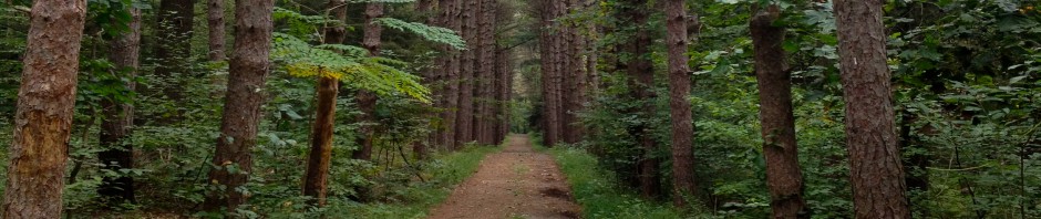
Saturday, Training Day.  We split into groups – Beginner, Intermediate, Advanced.  There was some quibbling with Husband about which group he belonged in.  He was surprised that we would not be in the same group, but since I’ve been doing this since the spring and he has never done it at all, I felt he would get more out of the Beginner group than the Intermediate with me.   The Intermediate was split into 3 groups and I chose the middle group. We went out with Ed Scott, a guy I really like who was also the course setter for Sunday’s event.  We all walked a course together, looking at features along the way, discussing route choice, getting to know the terrain.  I sort of paired up with Adam Steiner, who was very friendly and we shared what little knowledge we had with each other.  He was super nice and a very positive, cheerful influence on my day.  We went from 3 to 4 together – choosing to go out to a trail (not seen here in this pic, too lazy to take another) and then scoot back over after a deer enclosure.  I was off by a little, but Adam was right on.  We were the first ones in our group there.

On the way from 1 to 2, Ed stopped and showed us just how subtle the Re-Entrant can be here.

It really improves your off-trail confidence to be following someone who knows exactly where he is and where he’s going.  Then you can relax and really focus on observing everything around you and what it looks like on the map, instead of worrying about navigating.  This was a priceless exercise for me, and I need to do more of it.  Our route from 5 to 6 was essentially a route I took during my Orange course race on Sunday, even though I wasn’t going to the exact same place.  Previous to this training, I never would have had the confidence to navigate across great patches of white and green with no linear features to follow, using instead mostly my compass and a better understanding of contours.  While I still have a long way to go with contour reading, I picked up a little fearlessness I did not know I had in me, thanks to getting to know my Compass a little better after lunch.

For the Pace and Compass exercise, as you can see we had no features other than the controls to navigate by.  We had to take a bearing, and pace count to find these controls; going in whatever order we chose.  I actually stupidly never even thought about looking at the clues, so I was really flying blind.  This valuable lesson taught me that I need to do a better job of keeping on a straight course, focusing on something on the horizon, walking to it, and then taking another bearing.  And just practice.  So much thinking going on, someday I hope I will not even think about it.  This compass work  was a huge, huge benefit and had a definite positive effect on my abilities on Sunday.

Ed Scott and I

After that exercise, most people were done with training for the day. Ed and I had a little chat about stuff, and I felt like I could still go out and learn some more.  So I asked Tom O, one of the other trainers for Intermediate, if he had anything else to do.  He gave me this map–which I looked at and thought to myself “Now what am I supposed to do with that??”

So, I grabbed Husband, who was feeling like he didn’t get out into the woods enough, and tried this Contour Reading exercise.  We also had a regular map of the area, and I had been out to some similar areas already on the Group course.  Tom needed to start picking up controls about an hour after we took off, so there was a time limit; I ended up cheating quite a bit – looking at the other map.  Husband and I didn’t function very well as a team on this, because of our different levels of experience.  I also didn’t feel experienced enough to be teaching him, since I barely know anything myself.  But I did learn a bit and felt like I got something out of this exercise.  I would like to do more Contour training, but next time I need an advanced level orienteer with me.

Sunday, Race Day.  After another crappy night’s sleep (it was in the 30s, okay?) we ate breakfast late and got ready.  Husband’s start time was earlier than mine.  This was my first experience with having a ‘start time.’  Mine was 10:26am, and after walking to the start, which was about 15 minutes away from the dining hall, I came upon a group of about 30 people waiting to go out.  Ed would call out the time, every minute, someone would grab their map and dip their fingerstick into the Start paddle, and go.  Because I was about 15 minutes early, I got to observe.  I observed those on the Orange going out in a certain direction.  This was helpful, but since I messed up the first control anyway it didn’t really do much.  Still, something to remember.

When it was my turn to start, I had already ascertained North and had the map oriented very quickly.  I pace counted 30 paces and then headed SE towards the Re-entrant.  But…I was too far east, and bounced around on the ridge for a little while, turned around, went too far West, and then when I came back E again I hit it.  This first one was a huge bad mistake and took me 8:21 to complete!  I was really walking around thinking “I suck.  Why did I think I could do this?”  But, after you find a control I guess there is a fresh start mentality that helps!  To number 2, I headed SE down into a rocky area, and farther E to the edge of the most northern marsh.  The clue was western edge of marsh, and thinking back, I really got confused here because I was thinking north was west, and thinking I should be seeing it.  Still, the actual marsh was only a small little piece of a marsh compared to the two big ones, and I was all over the marshy area (but not really in it) before I got my map right.  Seeing the West Point cadets crashing around with confidence was also intimidating.  I didn’t follow, though.  After 12 minutes, I found 2.  How pathetic!

Number 3 is where I started to actually use my brain.  Either that or there were more linear features for me to navigate by.  Went SE to the trail, followed the trail to the paved area, heading NE up the paved road while pace counting and looking off to the right.  Did not spot the control from the road, but went in early thankfully and was only in the rocky wooded area a short while.   3 to 4 – I had been in that area with Husband on Friday looking around, so I was already oriented a bit. Headed SE through the open field, through field with distinct trees and to path crossing the stream.  Ran up the stream, spotted the control and had to cross the stream on some rocks to get it.  4 to 5, turned around and went back the way I came – realizing with an “oh DUH” that I had forgotten to turn my Garmin on – ran down the stream and decided that the green looked too ugly and the paths looked too dicey for me to rely on – so I ran around the lake on the North side and crossed over at the dam, taking the path W for a few paces and then taking a bearing and looking for rocks.  I was a little too far W at first, corrected myself and gave the control away to a few other people accidentally. 5 to 6 I went NW to the power line break, followed it across the stream and to the path which eventually led to the part of the path I had already been on to get out of 2 area.  Essentially just ran to the top of the hill.

6 to 7, I should have gone around the marsh to the S, but because I already knew the way around the top to the N, I followed my old path, and ended up getting some soaked feet, oops.  I ended up running alongside the rocky area for a long time, and it was slow going.  Very slow.  I was somewhat comforted knowing that if I went too far N or S, I would run into the paved roads.  So, eventually got to it after just plugging away.  Really should have stayed to the S of the rocks, but was N of them. Control was not on the north side as indicated in the clue sheet, it was on the W side, so not visible until getting to the other side of it since I was coming from the E.  I was confused by this.  The cadets and I got to 7 at the same time and then they went running off like gazelles.  To 8, went NW, getting to top of stream bed and road intersection, and taking a compass bearing.  Hit the pit and 8 dead on.  Heading to 9, just took a bearing and headed N, careful to remain on even ground, and coming to the edge of the knoll and getting it no problem.  Hid behind a tree a few steps away to look at what to do next.  🙂

9 to 10.  Whew. This was the toughest leg of all.  I had been to the stone wall during Training, and remember Ed saying something about there being a control where you’d just have to aim and be within a margin to get it.  This was it.  I took a compass bearing, really trying to keep my eye on horizontal branches, get to them, take another bearing.  I noticed the stream beds here and there, but mostly, this was all about the compass.  I actually think I prayed here.  Prayed to find the stone wall.  And instead of doubting myself, I believed in myself on this leg.  I didn’t get there very quickly (11 min) but I got there!  I had aimed at what I thought was a little west of the junction of the stone walls, and guess what?  Exactly where I wanted to be.  Thank you, gods and goddesses of the woods 🙂

10 to 11, getting close now! During our training day, we had walked in some of the same area, so I was able to pick up the trail to the NW of the stone wall with no problem (the trail in real life is much smaller than it looks on the map!)  Picked up the trail, headed N, got to the ‘stream’ and then went NE into the light green, using a compass bearing to head up the hill through what I hoped would be mostly white woods.  Not so much.  I had my first mountain laurel experience in here, and I gotta say, I think being short is a good thing!  Got to the first knoll/spur thing, recognized it from training day (there is a deer blind in there,) and then headed towards the light of the clearing.  Bam.  Into the clearing, home stretch now.

Coming into the clearing, I saw Eddie setting up a camera.  Oh thank god he was too late to capture me running like a rag doll.  Identified the building I was running to (remembering in listed as a ‘craft store’ in a map Fred gave us at the beginning of the weekend,) and could have just run to it without looking at map, but made sure I didn’t mess up because wouldn’t that be a shame this late in the game?  Here, after punching 12, I think I heard my name said in a Lithuanian accent. 🙂  Running into the finish with Vadim and Hugh saying encouraging things, and people cheering, was just so totally awesome.  I’m only a beginner, and only doing the Orange, but it felt really good.

Live Results and Live Forest Cam!

I knew I messed up on 1, 2, and 7;  but I was hoping that the legs I did okay, and the fact that everyone else was making mistakes, would get me into the top 10.  And it did.  I finished 7th, and the first DVOA member.  I am just glad I finished!  I feel very good about this day, because it was ‘real orienteering’ for me.  Being so totally off trail, and having literally NO linear features to navigate by – that’s not an Orange course I don’t think.  So, I want to continue to train to get better at contour reading, compass bearing, and route choice, while also conditioning my body to be able to run for longer periods of time (and faster.)  Husband came in 2nd place in the Yellow Course!  (Did he even sweat, I wonder?)

Myrick – Orienteering Adventure

Morning control setting meetingHugh sets #44, the bridge controlearly morning water control stopHugh and Clem
Who always has a smile? Dasha!MacMac gives beginner instructionDory prepares her clue sheet
Caroline from FinlandFull Service course setterMalti the maltipoo gets lots of loveTom O
Malti!Esme of the angry Gummi bear team

MYRICK 9-09-12, a set on Flickr.

My first time event directing for DVOA – what a blast!  Myrick Conservation Center, at Brandywine Valley Association, is a lovely place.  Fields of sunflowers, scores of wonderful volunteers and participants, and great weather made this day awesome!

Garmin! came! in! the! mail!

Okay.  This is the best thing ever.  My brother organized everyone to chip in and get me this beautiful sucker, the Garmin Forerunner 410.  It is currently on charge, and I can’t wait to use it (tomorrow, I guess!)  The note that came with it:  “Summer Achievement Award for you! Put down the iPhone and strap on a real workout machine!”  AW – best family ever ever ever.  I guess they got tired of hearing me complain about how my GPS data is so variable while using my iPhone and GPS app of the week.  THANK YOU!

Garmin Forerunner 410 fresh out of the box, on charge

Tyler State Park – Green Course (first Advanced Course!)

Hey now! I did an advanced course! My first ever.  Though the terrain at Tyler (lots of trails, white woods, etc.) made things pretty easy, and this was more of an intermediate level Green course (but 20 controls!)  I was urged to try Green by a few DVOA-ers, and I must say – I’m glad I did.  Thanks for the push, guys.  It wasn’t like a push off the edge of a cliff, it was a nice friendly warm push into a green bush, like when I was a kid and my siblings would say “Ever been to Greenland?” and I, gullible to the bone, would say “No…?” and get pushed into the bushes.  Ah, memories.

I got off to a rocky rocky start, standing and staring at the map for well over a minute, just not being able to put things together.  I should always always have my compass to north before turning the map over and then move my body until things line up.  What the hell happened there I have no idea…it was like a big giant brain fart.  Ew.  But once I aligned things, I saw where I was and started running through a very very wet field which soaked my legs and shoes *squish squish* right at the beginning.

#1, no prob! A squishy knoll.

#2-#12 were all on the Bucks County Community College Campus, so an urban sprint of sorts.  The campus section was enlarged to 1:5,000 printed on the back of our 1:10,000 maps – extremely helpful!

I have never done this sort of orienteering, and I found myself thinking, “is this really orienteering?” but enjoyed it, though I did mess up in there a little.  #2 and #3, fine.  #4, mistook one building for the one I was looking for.  #5 went too wide.  #6 just not fast.  #7-10 all fine, if I could only go faster.   I had strolled through the campus once before, paying attention to buildings and looking at an old map, and that was key to me doing okay on the day of the event.  Navigating around buildings really takes some getting used to, I think, when you’re accustomed to looking at clearings and thickets and trails.  It’s hard to tell what goes through to where. From #10 to #11, I chose to go around the edge of the building to the North, and that ended up being a very steep rocky path next to a staircase (going up.)  In my mind, I was thinking I was taking a shortcut, because who would choose to go down the rocks like I was, and looking at the Splits, I did end up doing very well on this control (for me,) so maybe everyone else went around to the South.  I’m glad I nailed the Reentrant, because I haven’t done well on that feature in the past.   #13 was out of Urban mode, and I did lose a little time here.  I ended up going around the green to the South, cutting across the meadow and ducking into the green a little too North, popping back out and judging #13’s location in relation to #1’s location and popped back in to the green, walking SW and finding it.  (You can see all this better in the first map pic.)

From #13 to #14 was just trail running, at the junction of the clearing and trail. Bam.  #15, cross the bridge, path S to the first trail W, count paces and head S to look for the gulley.  This was not something you could see from the trail, but I did spot another orienteer coming out of there, so that was really helpful.  #15 to #16 I chose trails NW until the junction with the straight trail leading towards Neshaminy Creek, and then did a rough bearing NW through the woods, a little through the stony ground area, and then looked left to see a big big cliff with the control on it – a little bit of a climb with unsteady footing to get to it – whee!  That one was really fun.  #17 I kind of screwed up – went W on the S side of water, which was leading up and very steep, then gave up and crossed the water, went along trail until bridge, which looked like it went somewhere good, so I took that.  Trails S and W and N to get to the earth bank of #17.  So a lot of up and down and crossing water – certainly not boring!  #18, fine, woods to trails and then bearing to boulder.  To #19 was a fun downhill trail run, cross the bridge, and then stick close to water’s edge until trail.

#19 to #20 trails to parking lot across meadow to parking lot to trails, Finish I really ran out of gas.  I basically ran as much of this course as I could, and boy was I tired when I was done.  Makes me really want to train to run better.  So…how did I stack up against the other, more experienced orienteers on my first advanced course? (Although technically this was not really advanced orienteering, it was intermediate.) I came in 12th out of 31.  Not too bad.

FCE – DVOA Baptism Creek Event

actually it was 4.8km

Last Sunday’s Orienteering DVOA event at French Creek East went better than expected. (My second Orange course.) I guess I sort of over-prepared for it, but in retrospect I’m really glad I did. Going out and walking with the 1:15 map, and then being handed the new, 1:10 map on the day of the event was like suddenly being able to breathe underwater! Warning: this blog is post agonizingly boring but it’s an important way to document my growth and goals. If anyone actually reads it, you should get a medal.

For the #1 control, I just walked/jogged down the road, pace counting and looking for the trails on either side of the road; and then headed NE into the woods, seeing the clearing with the ruin in it right away. There was lots of waist high stilt grass around the ruin, making footing difficult especially combined with that first control eagerness. For #2 I went along the smaller trail, crossing the creek, and then headed across the white woods to the larger trail. Number 3 – I headed straight into the woods off of the T junction of the trail (where 2/8 is,) identifying the ditch and platform. Did a rough compass bearing to hit the power line south of the control, and walked along the edge of the power line break until I came to it. Saw a lone whitetail deer here.

Going from 3 to 4 was probably the trickiest control of the whole day. I started walking along the power line break and then thought about pace-counting and determining a point where I would then head towards the control area…remembered what my Dad said about the poles being accurately mapped, and so counted roughly 3 poles before taking a bearing and heading towards 4 while pace counting. The terrain from 3 to 4 was tough, lots of stilt grass again and couldn’t see my feet and also going up in elevation. But as I went over to 4 it got better and much to my surprise and delight I had aimed at it perfectly, there was the Pit and there was the control. Magic.

The way from 4 to 5 was just long, all on trails. I tried to interval walk/jog as best I could. Once it got downhill, I jogged. Apparently there was water at 5 but all I could see was the orange and white 🙂 From 5 to 6 I ran down the paved road at a good pace I think, and tucked into the woods after passing the fenced-in building. There was someone else right near the control so that helped.

From 6 to 7 I thought I had made a pretty good plan. I followed along the creek going in a SE direction, staying on the W side to avoid boulders, coming to the buildings and then trail to head over E to 7 area. Once on the trail, I pace counted and looked for the bend, that was my point to travel off of. But when I got to the bend, I just kept going straight and went between the control to my left and the boulders on my right, thinking I should be able to see it, since I had had such luck with visibility throughout the course. I was just a smidge too S and the control was obscured by vegetation – though it doesn’t look like it would on the map. Went to the road and ran up and down a little until I spotted it, and went crashing in. (Once again, stilt grass!) If there had been no control, I would have had to go back to the bend in the trail and think things through a little better. 7 to 8 was pretty straightforward, take the road and then follow the edge of the meadow. I turned N into the woods before the creek and and got it. For the last control it was just run down the trail. A little girl and her mom were at the control, taking a long time to insert the E-punch. I told the little girl she had ‘beat me to it,’ and what a great job she was doing. I did my best running to the finish but I am really not that fast!

It was a surprise to come in first place in Orange, when my plan had been to simply finish the Orange. Here are the splits. I got a lot of ribbing on the way home from Dad about ‘moving on up,’ meaning he thinks I should do an advanced course. I felt really good driving home and throughout the rest of the day, like actually deliriously HAPPY (even though I didn’t know I had won.) So happy that I made some life decisions based on wanting to be in DVOA-land for the next little while. Because if something makes me this happy, shouldn’t I keep doing it? What this day did was improve my confidence immensely, and just by a total fluke of scoring and who has done what events, put me in first place in my age category. I took a screen shot, because this is something that will never happen again (not with Angelica Riley and Sandy Ahlswede around!)

A one-time thing!

For the rest of this season, I think I’ll do mostly Orange, but try some Browns or Greens if they are at a venue where it seems appropriate. Maybe the next event, Tyler, is just such a place, because things are fairly open and the controls will supposedly be easy to see. But I don’t know yet. I’ll decide on the day of the event. By visiting the venue in advance, and walking some old courses, I really ease my anxiety about the unknown. It’s like scouting a location before the shoot day, in television. You want to know as much as you can about what to expect for the big day. I won’t always be able to do this, but for now I think it’s a helpful tool for me to ease my way into this sport. At some point, I’m going to have to get lost in the woods, but I will do everything I can to avoid it!

PS My dad did really well at FCE on this day too. His terrain was much more difficult going than what I had. GO Dad!