French Creek East

In about a week, there’s a DVOA meet at French Creek East.  As you can imagine, I’m trying to get ready for it any way I can.  The map they use for this venue is a different scale than I’m used to – most orienteering maps I’ve used are 1:10,000; last week’s map at Springton was 1:5,000.  This map is 1:15,000.  What that boils down to is that the map covers a lot more ground, so there’s a lot to look at, it looks very small comparatively, and it takes a longer time to get from one point to another on the map.  Bring on the magnifier, baby.

A magnifier is going to help me with the 1:15,000 map scale

While some orienteers don’t use magnifiers, some do; and not just with this scale map.  Here’s what Sandy Fillebrown, one of my orienteering heroes, has to say about magnifiers: “I have one attached to my thumb compass that swings out of the way when I don’t need it. I always have it and use it when I can’t figure out what’s going on in the circle. I occasionally use it between controls when it seems important to understand a complex trail/stream/bridge/gorge crossing and I’ll use it in a sprint when the details of which side of what fence you need to be on is important or something like that. Many times I won’t use it at all in a race, and then there will be one when I need it several times – it just depends on the terrain.”

I traced an old FCE Orange course over my Dad’s old Green course

Well, this terrain calls for a magnifier, in my beginner’s opinion.  Everything seems so…tiny and subtle.  So the other day, I borrowed my Dad’s magnifier, and went out to French Creek East to try and wrap my head around the map, and see what the terrain was like.  I attempted a DVOA Orange course from 4/2006; and with not much luck, actually.  My goal was to just go slow and get as many controls (features in this case) as I could.  Instead, I found myself wondering where I was a lot of the time that I was off-trail.  The scale is a big adjustment to make, when usually you walk 20 paces for 80m; here you walk 30 paces for 80m, and so on.   And it seemed to me there wasn’t a lot to see, or rather, there wasn’t a lot to see that I’m used to navigating with. I got really nervous out there, actually, and that was discouraging.   So then I just decided to stay on trails and see as much as I could; maintain contact with the map; identify what I could.  I ended up going 5 miles in about 2 hours…session data here.  A little ankle twist added to my downcast mood.

I got number 1 after a bit. Number 2, I misidentified at first, being farther south than I needed to. Number 3, I got really uncomfortable off-trail and went all the way to a trail to get.

Feeling really down about myself, (though it had been a beautiful day, and I know I’m seriously lucky to be on this planet, doing the things I want to,) I got home and did the usual logging on Attackpoint.  Later in the afternoon I was delighted to find some really nice notes from Sandy, my brother, and Speedy about FCE…and how I’ve turned “hard-core.”  I’m hardly hard-core guys, but it was good to hear that that others find the scale difficult, or have had a bad time there despite being really really good at orienteering.

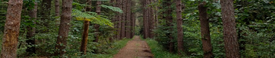
FCE woods and even trails were filled with downed branches

Speaking of hard-core, I had a funny encounter towards the end of my training session.   I spoke briefly with one of the workers clearing trails of downed branches after the forest fires.  As I went running away, she said, “thank you for your service.”  Couldn’t for the life of me figure out what she meant until I got back to my car and took off my hat – the Marines hat that I consider my ‘lucky hat’ that was too small for my Dad, the actual Marine.  So, she thought I was a Marine.  Boy was she way off! If only she knew my inner thoughts about how icky the bugs were.

FCE—-Lots of rocks and charcoal terraces.

Today, I stumbled on a great DVOA article by Eric Weyman on orienteering at French Creek:

  • “On the ground, the terrain is characterized by the lack of obvious, recognizable features.  While there is a near absence of medium-sized features, there is an abundance of small and subtle features; some would say that there is an abundance of “non-existent” features as well.
  • However, to orienteer well here, one must learn to recognize and even rely on many features that in other terrains are insignificant or unmapped.” 

I guess that’s why Speedy, another orienteering hero, says this about the terrain at FC: “I believe FC terrain is the best we have in close proximity to Philadelphia from a technical aspect of orienteering.”

Okay, I get it. This is a place to really improve my skills.  My brother wants to do some contour training with me, and is making me a little course to do with just contours, no other features.  At first I thought this idea was a mistake, too advanced for me, I’m not ready for that type of thing.  But I think differently after reading more from the Weyman article:

  • “The ripples are not the work of a nervous draftsman, but in fact accurately reflect the many subtle spurs and reentrants in the terrain. In addition, the spacing of the contours is also worth noting since they accurately depict changes in slope that are often more apparent in the terrain than on the map and are a very useful feature that most orienteers are not accustomed to using.”

2009 results from Orange at FCE – look at all the DNFs!

I looked back in the annals of DVOA Orange course results: there are many many many DNFs in Orange over the years.  Why is it so hard to set an intermediate course here?  The answer, in Eric Weyman’s aforementioned article:

  • “French Creek terrain provides typical beginner’s level orienteering, utilizing the trail network, a couple streams and the nearby point features. However, once the orienteer leaves the security of the linear features, the difficulty switches almost immediately to the advanced level.
  • So what does the Orange (intermediate) level orienteer have to look at? Probably the most usable feature is the stony ground, which often occurs in large, distinct pieces and functions as an area feature comparable to fields and marshes in other terrains. Even when the stony ground is complex in its outline, it can still be generalized into a usable area feature. To a lesser extent, areas of green (thick vegetation) can be generalized in the same way.
  • In addition, there are some intermediate-sized contour features that might not be obvious on the map but are recognizable in the terrain. One example is a multi-contour hillside that is noticeably steeper than the slopes above and below. Usually accompanying these steeper pitches is a “shoulder” at the top edge of the slope where it levels off and a “bench” on the lower side of the slope where it levels off before dropping off further below. For all of these features, it is important to pay attention to the spacing of the contours, which is a skill most orienteers rarely apply.
  • There are more common intermediate-level contour features such as ridges, valleys and hilltops that are mostly large, broad and can be counted on two hands to cover the whole map. Nevertheless, they can’t be ignored because there really aren’t many other intermediate-sized features.”

“Many first timers to French Creek comment that there are many details on the map but nothing to see in the terrain. It usually takes a return trip or two to realize that not only are the details all there, but they are precisely mapped, and, once the orienteer makes some adjustments, navigation is in fact possible.”

Rock on!

Other points from article I want to think about:

  • “The intermediate courses frequently require crossing through sections of terrain that only have advanced-level point features on the map. Therefore, accurate use of rough-compass technique is important to get to the linear or area collecting feature on the other side.
  • “Aiming off” is the compass technique of intentionally going to one side of the direct line in order to hit a collecting feature on the intended side, then proceeding along that feature in order to find the control or an attack point before moving on. This is used in situations where the likelihood of finding the objective by direct bearing is low and not worth the risk of missing it. At French Creek this applies almost everywhere, since there are few obvious supporting features.
  • Contour Reading: Though few intermediate-level contour features-such as valleys, ridges and hills-exist, the ones that are there are rather easy to recognize and must be utilized. While noting these shapes, you should also be aware of the direction of your travel relative to the contours, whether it is directly uphill or downhill, or at an angle to the slope of the hill, or directly along the slope, contouring along the hillside. Paying attention to the direction you want to travel relative to the slope, especially when used with rough compass, can be an effective combination.
  • Attack Points:  Of course, attack points are important on all levels of courses, but for intermediate-level competitors the application is simpler. Almost every reasonable Yellow and Orange level attack point will be right along a linear feature, usually a trail, but sometimes a stream or clearing. My advice can be boiled down to one rule: don’t leave a linear feature without first finding a sure attack point. One warning: often very similar features lie along the linear feature, such as bends, junctions, rocks, terraces, rootstocks, etc., so it is usually worth taking some extra time to check multiple confirming features before staking your attack. When carefully designed, French Creek Yellow and Orange courses aren’t necessarily difficult. In fact, there are probably more than the usual number of easy legs if the course setter properly errs on the conservative side when there aren’t appropriately difficult features. Usually the “O” problem is very straightforward: rough compass through the featureless hillside to the next linear feature, find a known point and repeat. This pattern and the other intermediate-level concepts certainly underlie the advanced-level orienteering as well, with a few more complexities thrown in.
  • Route Choice: French Creek can present route-choice problems. Legs here often involve the classic, “straight through the forest” vs. “around on the trail” decision. The contour [around] vs. climb situation appears less frequently because the gradual slopes present few climbs worth avoiding. The more frequent dilemma is the navigation-oriented route choice. Most respected orienteers advise that you base your route-choice decisions on ease of navigation, especially the risk involved in the final approach to the control. In no other terrain is this idea more important. Often at French Creek supporting features dictate only one or two reasonable approaches. It is a common practice to run wide off the straight line for the sole purpose of finding a handrail or a series of features that can be relied upon. Such a technical route choice accepts a known small time loss because of the longer route, over the possibility of a large time loss due to error with a straight-line route. It is one which many orienteers have never considered or applied but is critical to successful orienteering at French Creek.”

More on FCE later – I’m planning on returning there sometime early next week.  I’m hoping to successfully identify more than one or two charcoal terraces, as they seem to be an abundant feature, and could be very helpful out there in the subtle terrain.  I really wish I had read this article before I went!  (And I hope that the course setter for the upcoming meet reads it.)

Texas Longhorns at Why Not Farm on way home

My first Orange Course

Springton Manor, Wallace PA…Sunday 7/22/12

Mid 70s, high humidity. With my new birthday 3/4 running tights, and my new running waist pack to hold my iPhone uploaded with a new GPS app, I felt mostly ready for the day, while at the same time somewhat nervous to be moving up from Yellow to Orange…the start of “real orienteering.” To prepare, I had been doing a lot of “training” up in New England area, but with no controls to confirm my abilities. I had also spent a lot of time looking at the Springton map and remembering it from last year, making sure I could recognize features like – T – the hunter’s stand, and the brown triangle for a charcoal terrace (still haven’t seen one of those for real.) And looking at the Route Gadget from the orange course last year, imagining how I would do the course. What I didn’t do, and probably should have, was a lot more actual running to prepare for this day. Because the terrain was relatively easy, with basically one big hill, lots of roads/trails and open meadows, speed was important. And I don’t have a whole lot of that in the tank. However, I think I did okay, because I was always moving, jogging when I could, and walking fast the rest of the time. And I didn’t make too many mistakes.

Anyway, here’s the day in a nutshell. Hit the road with Pops, listening to inspirational music like “Witch of the Westmoreland,” by Stan Rogers. Go on, click on that song, it’s good. Registered, was warned of yellow jackets, did not freak out about that 🙂 Conferred briefly with Sandy about the clue sheet to make sure I understood everything, my only question was for #12, why would there be the ‘between’ symbol, and only have one boulder? Was among the first to get out there, a little after 10am. I listened to my Dad’s advice about going slow to the first control. Then got some jogging in after that. I really didn’t have any problems with any controls, it was SO awesome to actually have controls, and in a lot of cases I saw the controls before I saw the feature. The Routegadget is here, but my GPS app kind of failed me when I uploaded it and matched it against the map – it had me meandering back and forth across Indian Run, which I didn’t do. Still it’s fun to look at the altitudes and paces and stuff – so here’s the session data too.

My goal was to try to do the 4.2km in under an hour, and I achieved that and strangely, also came in first place. I say strangely because it looks like I would have been second place until the very end, when I somehow got to the last two controls much faster than other people. I don’t understand that, because 11 to 12 was the one long uphill, and I was basically walking the whole time. There was a choice to go “off trail” and I didn’t, maybe others did. And the last control, I think I got really lucky finding the path that on the map looked fairly large, but in actuality was no more than a deer path and quite hard to spot. I had been pace counting, and ‘felt’ that the trail should be there (exciting when that happens!). I tried my best to run it in on the last control and to the finish, and I know I’m not fast, but it was fast for me to have a cumulative pace of 13:25/km. According to my GPS, in reality I went 5.7km, so that’s even faster- 9:53/km plus the climb. I’m not sure what numbers I’m supposed to be focusing on here, but it sure is fun to have lots of numbers to play with. What’s even more fun is looking at the Splits.

All in all, it was a great feeling to have been so nervous about moving up to Orange, and then end up doing so well. I felt really good out there, always knew where I was on the map, and from an administrative standpoint did well looking ahead to the next control and refolding my map etc while in motion and in advance. I also had the extra clue sheet tucked into my waist band, so I didn’t have to keep unfolding the map to read it there : HUGE difference. I adjusted well to the 1:5000 scale. And I’ll say it again: having actual controls to spot in the woods was pure joy.

Finally, I have been very dedicated to improving myself and I think that’s paid off. However my dedication pales in comparison with that of a young Lithuanian fellow my Dad and I ran into on our way home, about 2 miles out from Springton, walking along the road with a backpack. We identified him immediately as a orienteer, and possibly lost. Turns out, he had taken a bus from A.C., a train from Philly to Downington, and had walked from Downington…just to get to the meet. And guess what course he’d be running?” The “longest one.” We turned around and gave him a lift the rest of the way.

Long pond, half a NEOC green course

Not sure I did too great, but good to get out and practice with the map.  I got dropped off, did 8 controls out of 14, and then walked the 3 miles home with a backpack.  The idea was to just go slow, keep contact with the map, and find what I could.  Not try to ‘do it all,’ but do a small amount as well as possible.

CLUE SHEET

#1: got it no problem

#2: pretty sure I got it

#3: went too far north, but came upon stone wall and redirected, got it

#4: pretty sure I got it

#5: not sure I got it

#6: got it no problem

#7: got a bit turned around if you can believe it!  redirected, no problem

#8: pretty sure I got it

This was the first time I went ‘off trail’ alone in a pretty unfamiliar place…so there’s that.

Walking, Pace Counting

I walk pretty fast, under 15 minute miles, pumping my arms and looking like a fool.  Today I sustained a 14:30min/mile pace for 6 miles on mostly streets, with only a touch of jogging thrown in on a downhill.  It was a good workout!  I think I earned the right to do not much else today.

6 mile route – Woburn, MA

Walking is the exercise that brought me back from the ‘dark side,’ and got me in shape.  Walking, not jogging, because of my bad back.  I started doing a mile at a time, then up to 2 miles, two or three times a week.  3 miles if I was feeling great.  (Now I almost always walk 4 miles, about an hour.)  This was over the course of the last couple years, in every kind of weather.  Mostly I walked on streets around my house to start, then I began going into the woods at state parks, where walking morphed into hiking.  Different shoes required.  The map and compass would accompany me too, because I like to know where I am and where I’m going at all times.  This applies to driving as well.  That’s why I love GPS technology!  I use an app for my iPhone called GPS Stone, that until recently worked great.  If it had worked today, I’d be using the data in this blog. 😦 Now I have to consider some other alternatives…maybe a Garmin watch with HR monitor?  Those are pretty expensive, though…I may not deserve one of those quite yet.  But I may be ready to start thinking about heart rates, something that has kind of put me off in the past (panic attack = fast heart rate = avoid fast heart rate.)

$290! Is there a less expensive, less goofy-looking version that works just as well??? Beam me up, Scotty.

Lately I’ve been trying to mix in some jogging into my walking routines.  I’ll do 50 paces of walking and 50 paces of jogging, or 100/100, and keeping the numbers in my head does wonders to make things go by quickly and also helps me judge distances – a good skill to have.

I go about:

  • 20 paces = 80m – the marks on my compass
  • 30 paces = 100m
  • 75 paces = 250m
  • 240 paces = .5 mile
  • 300 paces = 1km

I have little marks on my compass that equal 20 paces (about 80m) and when I measure that against a 1:10,000 map, I can tell how many paces it will take me to get from point A to point B.  Roughly.  My dad helped me figure that out, believe me this stuff confuses me.  I only just started pace counting, and I think it’s made a huge difference for me.  I like how the pacing replaces worrisome thoughts, too; aside from it being a great way to take a distance on the map and bring it into reality.  It will be interesting at Springton Manor, where the map is 1:5,000 – so each pace marker will equal 10 paces.  I’ll get there more quickly!

From 12 to 13 would be roughly 100 paces for me, but because this is the Springton Map, it’s 50 paces!

How to read an Orienteering clue sheet, I hope

Moving up from beginner to intermediate also means I will have to interpret the little symbols that describe the location of the control, rather than read plain English.   (I kind of froze a little at the relay a few weeks ago when I didn’t see actual words, thankfully they were all pretty straightforward!)  So for an Orange course, I’ll get a clue sheet that looks like this (except it will say Orange instead of Red):

clue sheet from a red course at pine hill

So what the heck is all that???  Okay, today I did some online studying and I think I can interpret this correctly.  Starting at the top it’s a Red course, that’s 2.6km long, with 85m of climbing.  The start location, which is the triangle at the top left, is at a path junction.

The clues and clue descriptions are described really well on this site. (Thanks to my brother for referring it to me. I’m just going to borrow some things from there and organize them here so it’s easier for me to remember.)  The columns going across mean different things.  Let’s take the 7th control off of the clue sheet as an example and try to dissect its meaning:

_____1______2______3________4________5_______6______7_______8____

Column 1 – Control Number (the 7th control)

Column 2 – Control Code on the flag (63)

Column 3 – Which of several similar features (the SW one)

which of several similar features?

Column 4 – The feature (knoll)

The features, from the Williams website

Column 5 – Details at the feature (bare rock – I learned this one today!)

Details at the feature – I love that we are identifying deciduous and evergreen trees!

Column 6 – Dimensions of the feature (none here but it could describe how high a cliff or boulder is)

Column 7 – Location of the control (the eastern edge or foot?)

Column 8 – Other info (usually drinks available)

So our example, the 7th control, would be #63, the SW knoll, on that knoll’s eastern edge/foot with bare rock. (Right??)

Here it is on the map so you can see you’re choosing out of two knolls:

Finally, there’s the very end row, which describes the last control to the Finish, in this case a marked route of 70m.  I’m assuming ‘marked’ means some streamers.

This can vary a little…

So, while I think I knew a lot of that, some I definitely did not know and hope I got right on this page.  Also very helpful and fun for learning clues — an online quiz!!  It’s really good practice.  There are still many clues I don’t recognize:

where you keep the hay?

Anyone have any fun clue-reading anecdotes?

Thanks to Williams College for their awesome pictorials!

O-Goals

I seem to have been bitten hard by the Orienteering bug over the past few months.  Actually, it was a DVOA event at Ridley Creek State Park in Dec 2010, with courses set by my dad, that started me on a wave of fitness resulting in a weight loss of about 30lbs.

I’ve lost 30 lbs since I started orienteering in Dec ’10

Since that race, I’ve logged many hours walking and hiking, hoping I could be better at Orienteering –  hoping I could stop worrying about getting lost in the woods, or what would happen to me if I had a heart attack in the woods – all the lovely thoughts that one has with Panic Disorder (from which I am making a very good recovery thanks to Cognitive Behavioral Therapy and lots of exercise.  See my Page on Panic.)

I’ve “competed” in 9 Yellow courses (beginner level,) and one Relay Event in the past 19 months in both the Philly and Boston area.  And now, I’m hooked.  It feels so good, because now I can actually jog a little! And…I want more.

But because there are no actual Orienteering events for a few weeks, and because I want to move up from Yellow to Orange, (people are saying “it’s time,”) I’ve been trying to “train” in my own fashion.  My dad was nice enough to shadow me on a previously competed Brown Course at Ridley Creek State Park on 6/27, which was very confidence-building in terms of getting off the trails and into the woods.  Apparently “trail running is not orienteering; real orienteering takes place only in the woods,” according to a NEOC article.  And to prepare for Orange, I must take those scary baby steps off the trails!  Because you never know what you might find in the woods!

Pink Lady Slipper Orchid – May ’12 at Breakheart Res in MA

So: what’s an Orange level course all about?  It’s considered Intermediate level and is 3.5 to 5.5kmlong.

From a NEOC article: Orange is the beginning of real orienteering, because controls are not visible from the trail and you must enter the woods. Controls are located on obvious terrain features, and the marker itself, at waist height, is clearly visible when approaching through the woods from a logical direction. Primary skills include understanding of the importance of an attack point: an obvious terrain feature within 100-200 meters of the control. The experienced orienteer always looks for an attack point first and not the control itself. Another orange-level skill is the ability to use the contour lines to distinguish between spurs (land that juts out from a hillside) and re-entrants (the little valleys between spurs). And it will be useful to take a compass bearing, often from the attack point to the control.

I’ve been taking old courses and trying to “run” them as if in a competition (I jog a little and mostly walk,) and because there are no controls, I’m learning to try and navigate to a feature, which is what you should be looking for in the first place (on the beginning courses you get instant gratification by being able to see controls right from the trails, etc.)  So, this is good.  But because I am still basically a beginner, and I screw up, sometimes it would be nice to have a control to know I got it right!  I think it’s probably not good to practice making mistakes…

On 6/28 I trained on a previous Ridley Yellow course that I knew well, in order to work on speed…FYI Ridley in the summer is a bitch!

And then coming back to the MA area, on 7/3 I trained on an old Orange course at Horn Pond from last year, and did okay.

I was reading an inspiring article off of the DVOA page, talking about training, that made me want to re-think what I’ve been doing:  “Training should isolate and improving specific skills, rather than repeat the competitive activity.” And since “Running, Navigating and Route selection are the three main skills that determine orienteering success,” I decided that for my next training activity I would take Running out of the picture entirely.  Take the clock away.

So today, I went out to Prospect Hill Park, in Waltham, MA, for a jaunt that lasted almost 2 hours, trying to complete a training course that Ross Smith of CSU (who now lives in Sweden, the birthplace of Orienteering) created for me in Jan ’11 that was too hard for me then.  The idea today would be to keep contact as much as possible. “Contact” is the O-term for the relationship in your mind between what you see on the map and what you experience in the natural world around you.   I felt very solid with this today, and being forced to slow down, I really did notice a lot more.  I didn’t really run except for maybe once or twice when I got bored with a long trail.  I found every feature, but got frustrated with my nemesis, the Re-Entrant.  All in all, it was a successful training mission.

Each time I orienteer (successfully) I have a feeling of great satisfaction.  In the beginning, I was fighting Panic more than anything.  Just going into the woods alone was enough of a challenge.  But now, I’m not even thinking about the “what ifs” of Panic, I’m just focused on the task at hand: getting from one point to another using a map and compass.  I’m even starting to have moments of real joy at the feeling of being in a forest, off a trail, alone, finding things.   It’s very empowering.

I want to continue to have fun and train until the next event, which is a DVOA Springton Manor on 7/22.